Last reviewed
Background
A vast highland prefecture where the Sichuan basin gives way to the eastern Tibetan Plateau.
Garze Tibetan Autonomous Prefecture stretches across western Sichuan through deep river valleys, forested slopes, grasslands and high passes. The G318 corridor links Kangding, Xinduqiao, Litang and Batang, but these places are destinations with distinct histories and landscapes rather than simple fuel stops on a race to Lhasa.
Tea-horse trade routes, Tibetan Buddhist monasteries, pastoral life and multilingual market towns shaped the prefecture over centuries. Today the same terrain supports long road journeys to glacier parks, sacred mountain landscapes and protected valleys, all of which require slower pacing, respect for worship and realistic altitude planning.
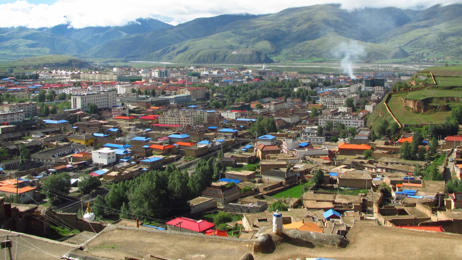
Kangding developed where routes from the Sichuan basin meet the eastern Tibetan Plateau. Its river valley became an important tea-horse trading center and is now the prefectural capital, a multilingual transport base and the most practical place to slow down before continuing toward higher grasslands and passes.
The Kangding municipality crosses sharp elevation and climate zones, from the compact river-valley city to alpine lakes, pastoral valleys and the Mount Gongga massif. Mugecuo, Xinduqiao, Tagong and Paoma Mountain are connected by history and roads but need separate weather and altitude decisions rather than one hurried photography circuit.
Within Luding County on Mount Gongga’s eastern slope, Hailuogou compresses warm valley forest, alpine terrain and a temperate maritime glacier into exceptionally steep vertical relief. Moxi is the valley-base gateway to this protected landscape, not a separate Destination from the wider Garze prefecture.
The 2022 Luding earthquake reshaped roads, trails and visitor infrastructure around Hailuogou. The reopened park now depends on managed transport, timed entry and route-specific weather controls, so pre-earthquake maps should never define a day’s plan.
Recommended itineraries
Recommended itineraries
Distances are large and sleeping elevation matters. Build the route around acclimatization and current road access, not the fastest schedule in an old road book.
Kangding to Batang along G318
A western Sichuan corridor route that gives each major landscape a real stop while avoiding the source’s unsafe marathon driving days.
- Day 1 · Travel from Chengdu to Kangding with a licensed driver or current public transport, then keep the evening gentle.
- Day 2 · Choose Mugecuo or a quiet Kangding morning before continuing to Xinduqiao; stop only at safe, designated viewpoints.
- Day 3 · Cross toward Litang, visit Changqingchun Ke’er Temple respectfully and spend time on Maoya Grassland without entering private pasture.
- Day 4 · Continue to Batang for Cuopu Valley or local town culture, checking road, weather and access notices before departure.
Hailuogou and Yading without rushing
A separate southern loop for travelers prioritizing glaciers and the Yading mountain landscape over through-driving to Tibet.
- Day 1 · Reach Moxi and confirm the latest Hailuogou access plan after checking weather and park operations.
- Day 2 · Use managed park transport and designated glacier viewpoints, then return for a second night rather than driving late.
- Day 3 · Transfer toward Litang or Daocheng with generous buffer time and a conservative sleeping-elevation plan.
- Day 4 · Enter Yading for the lower, shorter temple-and-meadow circuit.
- Day 5 · Attempt a longer authorized route only if current park rules, weather and acclimatization support it; otherwise repeat a lower circuit.
Kangding without the through-route rush
A focused base itinerary combining city history, one managed alpine-lake day and a separate grassland corridor.
- Day 1 · Settle into Kangding, keep the first hours gentle and walk the riverfront, central lanes and Anjue Temple. Add Paoma Mountain only if current access, weather and energy make it sensible.
- Day 2 · Give Mugecuo a dedicated day, using the current managed transport system and carrying warm, waterproof layers.
- Day 3 · Travel toward Xinduqiao and Tagong with a licensed local driver or verified transport, stopping only at safe pull-offs and treating villages, pasture and the monastery as lived cultural landscapes.
Moxi and Hailuogou at a safe pace
A focused eastern-Garze extension that separates Moxi’s history from the park’s managed mountain route.
- Day 1 · Settle in Moxi, walk the old street and see the Catholic church and Moxi Conference historic area from currently public zones. Check same-day notices before adding an exhibition hall or museum because closures can change.
- Day 2 · Enter Hailuogou with a reserved time slot, use the official shuttle system and follow the open route through Caohai’s forest toward only those upper viewpoints released that day. Return by managed transport; add a licensed hot-spring facility only if time and your condition allow.
Attractions & practical tips
What to see—and how to approach it.
Kangding and Anjue Temple
康定与安觉寺
Kangding’s river valley and market-town history make it the natural threshold between the Sichuan basin and the plateau; small Anjue Temple adds a living religious layer near the center.
Practical tips
- Use Kangding as an acclimatization and logistics stop rather than pushing immediately to a much higher sleeping elevation.
- At the temple, dress modestly, follow local circulation and ask before photographing worshippers or interiors.
Paoma Mountain
跑马山
The wooded mountain above central Kangding is closely associated with the city's famous love-song tradition and provides a high viewpoint over the river valley.
Practical tips
- Confirm current paths, operating areas and any cableway service before setting out; the source's prices and hours are obsolete.
- Treat festivals and song traditions as living culture, ask before filming participants and avoid reducing Kangding to one romanticized lyric.
Mugecuo
木格措
A managed alpine-lake landscape north of Kangding, with highland water, forest and mountain views changing quickly with weather.
Practical tips
- Check the official park channel for current entry, shuttle and weather arrangements instead of using the old guide’s prices.
- Carry warm and waterproof layers and avoid informal horse or boat offers outside authorized operations.
Xinduqiao
新都桥
A broad highland valley known for shifting light across fields, villages, poplars and distant mountain ridges.
Practical tips
- Photograph from legal pull-offs and village paths only; never stop on a blind bend or walk into fields without permission.
- Treat it as an inhabited landscape, keep drones grounded unless explicitly allowed and ask before photographing residents.
Tagong Grassland and Tagong Monastery
塔公草原与塔公寺
An inhabited pastoral landscape surrounds Tagong town and its important Tibetan Buddhist monastery, with distant mountain views and religious, trading and grazing histories meeting in one place.
Practical tips
- Use public or clearly permitted paths, never drive onto pasture and keep distance from livestock and working herders.
- At the monastery, follow current visitor rules, circulate as indicated and ask before photographing people, ceremonies or interiors.
Litang and Changqingchun Ke’er Temple
理塘与长青春科尔寺
High-elevation Litang combines an expansive grassland setting with one of the area’s important Gelug monasteries and a strong tradition of pilgrimage and trade.
Practical tips
- Plan little strenuous activity on arrival and reconsider sleeping here if altitude symptoms are developing.
- Do not enter ceremonies, monastic quarters or prayer spaces simply to photograph them; follow posted and spoken guidance.
Maoya Grassland
毛垭大草原
A wide pastoral landscape west of Litang where river channels, grazing grounds and distant ridges open beside the highway.
Practical tips
- Use marked viewpoints and do not drive onto grassland, disturb livestock or assume pasture is public access.
- Wind, cold and storms can arrive quickly even when the road below looks clear.
Genyen Massif
格聂神山
A sacred mountain landscape south of Litang, with high valleys, monastic sites and remote roads requiring careful local planning.
Practical tips
- Use a locally informed, authorized route and verify seasonal road access before leaving Litang.
- Respect sacred boundaries, avoid climbing or drone use where prohibited and leave no trace at camps or viewpoints.
Batang and Xianzi culture
巴塘与弦子
Batang is a lower valley town near the Sichuan–Tibet border, known in the source for communal xianzi song and dance as well as its corridor history.
Practical tips
- Seek a community or officially presented performance rather than treating ordinary gatherings as a tourist show.
- Ask before recording performers and avoid copying sacred or ceremonial movement without context.
Cuopu Valley
措普沟
A remote Batang landscape of lakes, forest, geothermal features and mountain scenery reached well away from the main corridor.
Practical tips
- Confirm current park operations and the realistic return time before setting out; the old guide understates remote-road variability.
- Stay on managed paths around water and geothermal ground, and never approach wildlife to stage photographs.
Hailuogou Glacier Park
海螺沟冰川森林公园
On the eastern side of Mount Gongga, Hailuogou presents glacier, forest and steep vertical relief through a managed visitor system.
Practical tips
- Check current reopening, shuttle and viewpoint rules; geology, weather and repairs can change which zones are available.
- Do not leave barriers or step onto glacier ice without an authorized activity and qualified supervision.
Moxi Old Street and Catholic church
磨西老街与天主教堂
Moxi’s old street is the historic gateway to Hailuogou, where timber shopfronts, a Catholic church and the Moxi Conference sites place mountain tourism beside trade, migration and twentieth-century history.
Practical tips
- Walk the public historic area before or after the park rather than treating Moxi only as a hotel stop.
- Check current access: the Red Army Long March Moxi Exhibition Hall closes on Mondays and the Gongga Natural Resources Museum on Tuesdays, except public holidays; seasonal hours and worship or conservation needs can also affect entry.
Caohai forest trail
草海子森林步道
A managed forest-and-wetland route near the park’s lower visitor zone introduces Hailuogou’s vegetation gradient through streams, mature woodland and seasonal rhododendrons.
Practical tips
- Stay on the released boardwalk or trail, keep plants in place and carry every item of waste back out.
- Keep well away from macaques and other wildlife; never feed, call, touch or stage close photographs.
Camp No. 1 forest zone
一号营地森林区
The lower former camp zone sits within Hailuogou’s sharp transition from inhabited valley landscapes into dense protected forest and higher mountain terrain.
Practical tips
- Treat camp names as orientation history, not a promise that old accommodation or facilities still operate after reconstruction.
- Use only current stops released by the park’s shuttle system and do not leave the managed visitor corridor.
Managed Hailuogou hot springs
海螺沟温泉
Geothermal springs around the Hailuogou–Moxi area create a warm-water counterpoint to the glacier and snow-mountain landscape.
Practical tips
- Use a currently licensed facility and follow its posted temperature, timing, hygiene and supervision rules.
- Treat bathing as leisure rather than medical treatment, never drink the water and leave the pool if you feel unwell.
Camp No. 3 and Gongga viewpoints
三号营地与贡嘎山观景点
Upper managed viewpoints around the former Camp No. 3 zone can frame Mount Gongga’s snowy ridges when cloud, season and the day’s route align.
Practical tips
- A clear mountain view is never guaranteed; check the forecast and current transport plan without sacrificing safety for a photograph.
- Use designated viewing areas, keep tripods out of circulation routes and avoid crossing barriers for a cleaner foreground.
Camp No. 4 and upper glacier viewpoints
四号营地与高处冰川观景点
The park’s upper viewing zone opens broad perspectives across forest, glacier terrain, the great icefall and the Mount Gongga massif when cableway and weather conditions permit.
Practical tips
- Confirm the day’s cableway, shuttle and upper-zone status before joining a queue; weather or geological controls can change access quickly.
- View glacier features only from released platforms and paths—never step onto ice, moraine or closed terrain.
Yajiageng Red Stone Park
雅家埂红石公园
A red-stone river valley on the Hailuogou–Kangding corridor pairs boulder fields colored by specialized organisms with forest, water and high-mountain scenery.
Practical tips
- Use the authorized park route; do not touch, move, stack or remove red stones because the visible surface is a sensitive living association.
- Check road and attraction status separately from the main Hailuogou ticket before committing to the corridor.
Yajia Love Lake
雅家情海
A highland lake and forest stop in the Yajiageng corridor offers a quieter landscape break between Hailuogou and Kangding.
Practical tips
- Treat romantic legends as local storytelling rather than verified history and keep the lake edge free of staged props or litter.
- Official ticketing listed Yajia Love Lake as temporarily closed at the latest review; keep it out of a firm itinerary until the scenic area announces reopening, and never substitute an informal track.
Yanzigou
燕子沟
A separate valley on Mount Gongga’s eastern side contains forest, red-stone landscapes and distant glacier terrain, making it an additional managed excursion rather than an extension of the main park day.
Practical tips
- Official ticketing listed Yanzigou as temporarily closed at the latest review; confirm a formal reopening before leaving Moxi.
- Do not enter undeveloped side valleys, climb, camp or hire an informal guide for a closed route.
Yading Nature Reserve
稻城亚丁
Yading’s protected landscape centers on the sacred peaks Chenresig, Jampelyang and Chanadorje, with forests, meadows and glacial lakes arranged across demanding high-altitude terrain.
Practical tips
- Start with a lower circuit and use only open park paths and transport; a famous lake is not worth ignoring weather, closure or symptoms.
- Carry back all waste and respect the sacred status of the peaks by following local and park restrictions.
Milk Lake and Chonggu Temple
牛奶海与冲古寺
Milk Lake is one of Yading’s high glacial lakes, while Chonggu Temple anchors a lower cultural landscape beneath the sacred mountains.
Practical tips
- Treat Milk Lake as an optional high route, not a required achievement; turn back for symptoms, storms or park instructions.
- At Chonggu Temple, keep voices low and avoid blocking worship or photographing people without consent.
Food & dining
Eat with a little local context.
Meals change with elevation and supply routes. Expect Sichuan staples in larger towns and Tibetan plateau foods farther west, while keeping expectations flexible in remote areas.
Kangding yellow liangfen
康定黄凉粉
Cool, slippery starch noodles dressed with chile, vinegar and aromatics make a quick Kangding snack.
Try it this way: Ask for less chile if needed and choose a busy, clean stall where dressings and bowls are handled carefully.
Litang hand-torn meat
理塘坨坨肉
Large plainly seasoned pieces of boiled or roasted meat reflect highland pastoral cooking and are usually shared.
Try it this way: Confirm the meat and portion before ordering; vegetarian options can be limited, so arrange them early.
Air-dried beef
风干牛肉
Dense cured beef is a portable plateau food with substantial variation in salt, spice and texture.
Try it this way: Buy sealed or freshly cut portions from a reputable shop and keep the first serving small while acclimatizing.
Batang zhazha noodles
巴塘炸炸面
A Batang noodle specialty served with a savory topping or broth, suited to a restorative meal after a road day.
Try it this way: Ask the kitchen what the day’s topping contains and order vegetables alongside it when available.
Barley, butter tea and highland yogurt
糌粑、酥油茶与高原酸奶
Barley-based staples, savory butter tea and tart yogurt recur across western Sichuan and provide a useful counterpoint to chile-heavy meals.
Try it this way: Accept small servings first, mention dairy restrictions clearly and avoid assuming every household preparation is a commercial tasting.
Sweet-potato noodles with pork intestine
肥肠粉
Soft sweet-potato noodles sit in a chile-red pork broth with braised intestine, pickled greens and crisp soybeans.
Try it this way: Confirm that you want offal, ask for less chile if needed and choose a busy kitchen serving the broth piping hot.
Kangding spring rolls
康定春卷
Thin wrappers enclose shredded vegetables and sometimes meat before being dressed with a bright, spicy sauce as a small local snack.
Try it this way: Ask about the filling, raw vegetables, peanuts and sesame, and buy from a clean stall with covered ingredients.
Kangding potstickers
锅贴
Pan-fried dumplings with a crisp base come with pork, beef or vegetable fillings shaped by the city's varied food traditions.
Try it this way: Confirm the meat and cooking fat, and let freshly cooked dumplings cool before biting into the hot filling.
Moxi old cured pork
磨西老腊肉
Winter-cured pork is salted, lightly smoked and air-dried, producing firm slices with a concentrated savory flavor associated with Moxi households.
Try it this way: Ask whether the serving is steamed, stir-fried or paired with vegetables, and expect a salty, fatty dish best shared.
Moxi corn cakes
磨西玉米馍
Fresh corn is ground into a coarse batter and cooked into a gently sweet local cake that reflects the warmer valley’s staple crops.
Try it this way: Try a small freshly cooked portion and ask whether sugar, wheat flour, dairy or frying oil is added.
Moxi Yi tuotuo meat
磨西彝族坨坨肉
Large pieces of beef or mutton are boiled simply and shared, a communal Yi preparation whose meaning extends beyond a quick protein stop.
Try it this way: Confirm the meat and portion, accept a small serving first and do not turn a family or festival meal into an unsolicited performance.
Old-leaf tea
老荫茶
Coarse tea leaves are simmered into an everyday pot shared in homes and simple teahouses, offering a plain, warming alternative to packaged drinks.
Try it this way: Ask whether the pot is sweetened and use boiled water; treat a household invitation as hospitality, not a guaranteed tasting.
Seasonal mountain greens
时令山野菜
Spring and summer tables may feature cooked local greens such as fern shoots, houttuynia and mountain chives alongside heavier meat dishes.
Try it this way: Order identified, fully cooked produce from a regular kitchen; never forage in the protected landscape or buy rare medicinal plants.
FAQ
Questions worth answering before you go.
How long does a Garze trip need?
Five to eight days is a practical minimum for one corridor or southern loop. Combining Kangding, Batang, Hailuogou and Yading into a single fast circuit creates excessive driving and poor altitude pacing.
How should I plan for altitude?
Rise gradually, keep the first high days light and avoid increasing sleeping elevation too quickly. Previous fitness does not prevent altitude illness; worsening symptoms require stopping ascent and seeking qualified help.
Should international visitors self-drive G318?
Do not assume that an overseas license or an old road book makes self-driving legal or safe. A licensed local driver or verified public transport is the simpler default; confirm vehicle, driver, insurance and access requirements before departure.
Are the road times in the source guide still reliable?
No. Construction, weather, geological hazards and traffic controls can change the day’s plan. Check current transport-authority notices and build enough daylight buffer to avoid pushing on after a delay.
What cultural etiquette matters most?
Follow posted and local guidance at monasteries, walk around sacred objects in the indicated direction, ask before photographing people and never treat pilgrimage, burial or private religious practice as a spectacle.
When is the best time for Kangding and eastern Garze?
Late spring through autumn offers the broadest access, but summer rain can disrupt roads and views, while autumn nights turn cold quickly. Winter brings snow and ice with more limited services. Check short-range weather and official road or scenic-area notices for the exact route.
How much time should I allow for Hailuogou?
Allow two nights in Moxi: use the arrival day for the historic town, then reserve one full day for the managed park route. Treat Yajiageng or Yanzigou as separate excursions only after confirming their current access rather than squeezing either into the glacier day.
Do I need to reserve Hailuogou in advance?
Use the official timed-entry system and recheck the same-day capacity, shuttle and cableway notices before travel. Prices, departure times and camp facilities can change, so confirm each detail through current official channels.
Can I explore the glacier or side valleys independently?
No. Use only routes and viewpoints currently released by the scenic area. Unauthorized hiking, climbing, camping, skiing and entry into undeveloped or closed terrain are prohibited, even when an old map or social post shows a path.
What should I wear in Hailuogou?
Carry warm layers, a waterproof outer layer, sun protection and shoes with reliable grip. Conditions change sharply with elevation, so check the short-range forecast and park notices rather than packing for Moxi’s valley temperature alone.
How should I behave around Hailuogou’s wildlife?
Keep your distance and never feed, touch or call wild animals for a photograph. Macaques can grab food or become aggressive, so secure snacks and follow staff instructions instead of approaching them.